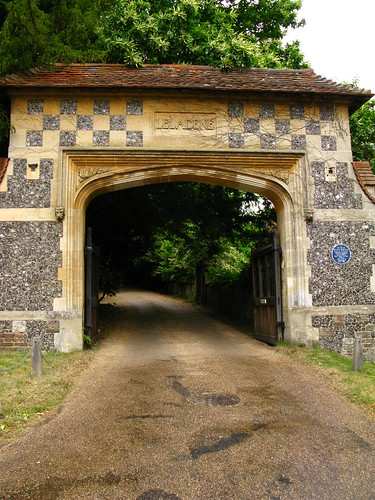
This region is very old. Right from the start, I saw traces of ancient stonework. We walked past an old archway and gateway but took neither path.


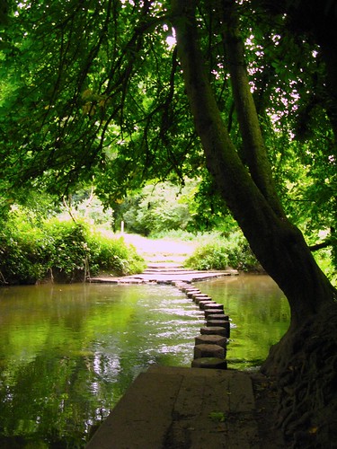
Instead we made our way through overgrown fields to cross the River Mole, which is thought to have got its name from a tendency to disappear underground in dry weather near Dorking, by using its stepping stones. Thankfully, the water had not swelled to cover the stones either, which would have caused a detour.
Not long after, we began our first ascent. The first hill was fairly steep at the start, and then slowly leveled to a more gradual uphill walk. I kept my eyes peeled for box trees, from which Boxhill was named. Box trees used to be in demand for making woodcut blocks and mathematical rulers, but more interestingly, box wood is heavy and does not float in water.
Without Dr Phil, I was somewhat clueless. I did note several fallen tree trunks that seemed more dense than usual, but I couldn't be sure.
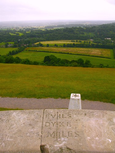
Soon we reached the top of Boxhill, which offered wonderful views across valleys and towns. According to the walking guide, Boxhill is 172 metres above sea level and contains Bronze Age burial mounds. It has also had some literary significance - Daniel Defoe described scenes of drinking, dancing and debauchery on Boxhill; Jane Austen placed the picnic scene in Emma here; John Keats climbed Boxhill by moonlight whilst composing Endymion.


There was a marker in place top give a general orientation from the hill top to other hills. I was curious - what is Devil's Dyke? Perhaps I'll find out at some point during one of our walks.
From this peak, we followed the Happy Valley path northwards and descended below Lodge Hill and Juniper Top (a valley of moss and lichen-covered trees).

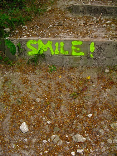
All too soon, we began our second ascent. This climb up to White Hill is much steeper, I definitely felt the struggle, which made this little smirk from some wiseass somewhat infuriating.
After this invigorating climb, we descended down to Mickleham Downs. St Michael's Church in this old town, has Saxon and Norman origins and was renovated by the Victorians.

Lunch at the Running Horses pub was a huge roast beef and yorkshire pudding. Thankfully, after lunch, the walk was much gentler.

The path led past some cow farms, which was a little unpleasant - unlike the usual few cows out to pasture in the fields we've visited so far, these fields were full of cows, swollen and uncomfortable with milk. The road and pathways did not just have the usual cowpats, but the earth seemed to have a layer of manure.

We crossed some fields and were supposed to follow the rest of the river to Leatherhead. Unfortunately, the riverside walk was under works, so we had to take a parallel but not so picturesque path.

We arrived fairly early in the ancient town of Leatherhead. Of Saxon origin, Leatherhead appears in Domesday Book of 1086 as Leret. We sat in the pub for a drink while waiting for the train.
No comments:
Post a Comment