Saturday 4 October 2008

Project Enlighten Report

I spoke with Asad from Project Enlighten the other day about their efforts over in Burma. Apart from some exciting developments in the pipeline (more scholarships and sustainable programmes), he also forwarded me some reports on how the monies were spent.

I don't know about you but when I think about the goal of $1000, I kinda feel it really isn't that much even though it's taking a while to accumulate. It's hard to imagine what kind of difference it would really make.

I feel pretty humbled and moved when I saw their spreadsheets.

Tinned fish. Cooking oil. Instant noodles. Rice. Blankets. The basic fundamentals to survive.


The road to rebuilding is long. Thankfully, they're getting started. They're also building wells so the villages have access to clean water.


The good thing about walking is it teaches you, the longer you walk, the longer you can walk. That's definitely useful when there's quite a way to go!

Tuesday 30 September 2008

Goal miles reached!

Two hundred miles clocked!

However, as we've yet to reach $1000, just got to keep walking!

Saturday 27 September 2008

A.A. Milne Walk - 15 miles

Perhaps it's because of the universal attraction of Pooh Bear, but for some reason, we had more guest walkers today than ever before. Two scientists from Dr.J's lab and Chris, a friend of my colleague, with his most suitable last name, came along. We've been doing these walks for a while now. And while it's usually good whether we are few or many, having some fresh feet along for the jaunt injects new energy into the group.

From London Bridge, we got the train to Ashurst.


As we moved out into the countryside, I chuckled as Chris audibly reacted the change of locale by commenting, "Hey, even the graffiti is more soothing out here."


The walk was very picturesque as the weather was glorious. There was a sense of enjoying it to the fullest as this might be the end of summer and the beginning of the winter period of short days.

IMG_4243a

IMG_4250a

Our new group dynamics quickly found its stride, as various folks split into groups according to pace. This didn't last throughout the walk, as quite often, there were shifts. It was great as we got a chance to chat and get to know different people.


The tree caught my eye. It was startlingly bleached against a vibrant backdrop.

IMG_4258a


I was a little disappointed that this toadstool had lost its spots. But Chris had a marvellous shot of one that looked like something out of a fairy tale, with folk living under it. According to Chris, many animals seek out plants for their hallucinogenic qualities and are quite inebriated during certain seasons. I've never witnessed it myself, but having seen the cats at the studio get a little silly over catnip, I'm convinced.


We made our way into the famed Five Hundred Acre Wood of the Winnie-the-Pooh stories.

IMG_4262a

We stopped on the bridge of Pooh Sticks. It amused me that there were posters in English and Japanese. Japanese folk must love Pooh. Of course, a game ensued. Chris won! "It's all in the selection," he grinned.

I lagged behind to pose Edward on the bridge. Some kids were clattering back and forth. One of them spotted Edward and shouted, "Look, someone left a bear!"

"He's mine," I snarled, to my surprise. No kid is getting his grubby hands on Edward!

Bear at Pooh Bridge

IMG_4289a

Whenever I think I've seen it all, something still surprises me still. We peered behind a bushel and spotted this. There were excited gasps all round. A couple of us edged nearer for a look.

IMG_4293

Finally, we reached Pooh Corner in Hatfield. It was just closed but we managed to beg entry into the shop for a few minutes.

IMG_4298

It was obviously a very quaint part of the world.

IMG_4315

It was the longest walk we've ever had. We were definitely glad when it was over and we could celebrate with a few choice sips of whisky at the train station.

IMG_4316

Saturday 20 September 2008

Taking Ben Nevis - 8 miles (Altitude 1344m)

As the highest mountain in the British Isles at 1344m, Ben Nevis is a hugely popular destination for trekkers and climbers. On different sides of the mountain, lie various routes of different levels of difficulty. We approached our ascent from the south side, on the easy trekking route, known as the Pony Track.

We crossed the wide valley and began the ascent after the first fence.


The weather forecast had been rather optimistic. In reality, the weather conditions were less than ideal. It began as being rather damp and chilly, and as we moved further up the mountain, visibility became quite dire with fog and rain. We could just about make out the valley floor between clouds of fog.


Here, the visibility got pretty bad. I could barely see ten yards ahead. The rain got heavier, until my trousers and bag were soaked, and water was running off my eyebrows and chin.

IMG_4132a

For a brief moment, the winds blew a clearing in the clouds. We could see Lochan Meall an t-Suidhe, which is a little lake nestled high in the mountain range itself. Beyond that, is the elbow formed by the confluence of Loch Linnhe with Loch Eil.


At around 1000m, Dr. J and Jo vetoed and headed back down. I don't blame them at all. The weather and visibility were poor. We were soaked and it was getting quite late in the day.

However, Ali and I decided to push on. I think at the back of my mind, I wasn't sure when we'd head this way again. Though my legs were aching, I kept telling myself I'm pretty lucky to have legs and to be climbing up this mountain. I think it's partly my innate pigheadedness. I really really wanted to get to the top, despite the pain.

Cairns marked the last couple of zig-zag turns near the top, and also to help keep walkers on the path.


Yeah, I don't really want to be wandering off that ledge down the steep fall of the North face. This side is where the climbers emerge, after hauling themselves up the huge buttresses that overlook Coire Leis.

IMG_4152

The mist made the summit look suitably spooky, especially with this war memorial, the highest in Britain. Just behind it, lie the old ruins from the Observatory. We didn't stay long, just long enough to share a dram of whisky with a few random hikers.


It's interesting that the etymological meaning of "Ben Nevis" is that it's an anglicisation of the Gaelic name Beinn Nibheis. While beinn is the most common Gaelic word for "mountain", Nibheis is variously understood, though the name is commonly translated as "malicious" or "venomous mountain".


According to the wiki, an alternative interpretation is also that Beinn Nibheis derives from beinn-neamh-bhathais, from Neamh "heavens, clouds" and bathais "top of a man's head". A literal translation would therefore be "the mountain with its head in the clouds", though "mountain of Heaven" is also frequently given. On our way down, a gust of wind blew the clouds aside, cleared our vision and we caught a glimpse of Loch Linnhe. It was quite breathtaking.


It took ages to get down the mountain. With wet, slippery rocks, I found myself moving with great caution. After what seemed like forever, we finally reached the stream we crossed on the way up.

IMG_4177

As dusk fell, that beautiful pre-sunset glow hit the hills. It would be another couple of hours before we hit ground, got out of our wet clothes and foraged for a late dinner.


IMG_4183a

For more details on the Ben Nevis trail, check out this website.

To the Highlands

We were up at the ghastly hour of 3.30am. Ali roared up on his bike not long after, and set off for Stansted Airport. It reminded me a little of the road trips I used to take with my parents. My parents used to have holidays where we would drive up either the east or west coast of Malaysia. In order to avoid the rush of traffic at the Singapore-Malaysian causeway, we would set off hours before dawn. I used to get a little excited as we'd have to sneak around so as not to wake the neighbours.

The roads were fairly empty on the way to Stansted, but the airport itself was churning as expected. It surprises others how much I dislike Stansted in this state. Airports to me, should be quiet sanctums in the early hours. Sacred stopway for those of us who like to slip in half light between places and realities. This Stansted is no better than a mall, packed with bargain hunters and hangabouts, like myself.

We got into Prestwick and Jo picked us up a little later. After one or two stops where we dithered a little longer than recommended, we were on our way to Fort William.

Just shortly after noon, we pulled into the car park that looked up towards Ben Nevis.

Friday 19 September 2008

Ben Nevis, here we come

All packed and ready...just need to get a couple of hours of sleep before we make the bleary, weary-eyed journey to Stansted, that human campsite of an airport. From there, we'll fly via Ryan Air to Preswick Airport near Glasgow.

Then we head up Ben Nevis. As the highest mountain in the British Isles, this is going to require quite a bit of sweat and panting.

So if you've been thinking about donating, please do! It's all going for a great cause.

Monday 15 September 2008

Couldn't agree more!

Wise words from Eastbourne!


Sunday 14 September 2008

We did it! Rawr! Seaford to Eastbourne - 14.6 miles

After a few delays due to bad weather and various walkers being away, we finally managed to get our act together for what Ali calls, THE BIG KAHUNA, the big dickens, the granddaddy of all the walks - the level 10 difficulty 14.6 mile trek from Seaford to Eastbourne.

We'd been saving this walk for ages, waiting for the right time when we felt strong enough. Finally, it was time before the days got any shorter and it'd be too dark. It was also a fitting crown for the end of the summer season.

We made a semi-early start from Victoria and headed on towards Lewes, to make a change for the Seaford train. Seaford is pretty pleasant as seaside towns go, much prettier than Folkestone and a lot less busy than Brighton. It was a bright sunny day, and all manner of walkers were out for a jaunt.

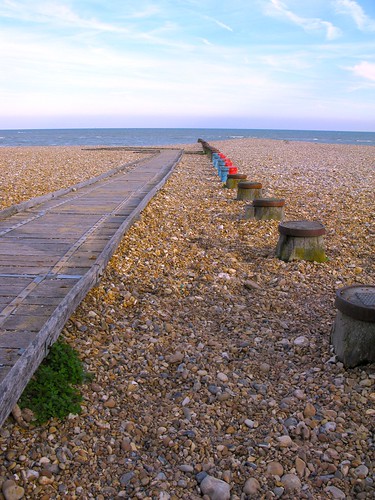
The seafront was very clean and picturesque, complete with the cutesy candy cane bathing huts. Psst, this beach is largely artificial due to sand and stone having to be imported to top up the washed away beach.


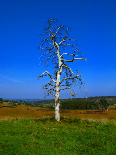
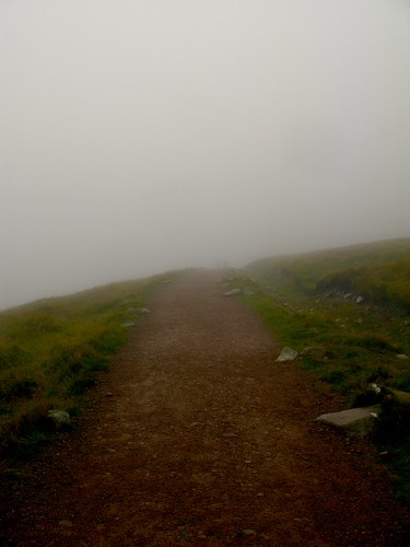
Quite quickly, we made the first steep ascent up the cliff to traverse a large green plain with sheep.


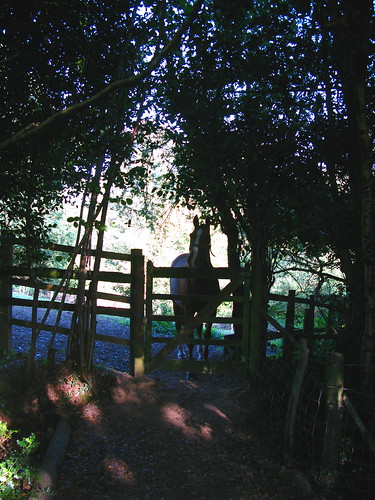
This house reminded me of that lone barn in the high yak pastures of the Himalayas. I'd love to live somewhere like that - with miles around me, undisturbed. But no sheep, thanks.


This coastal route is one of the best in England, where the path follows the rolling white cliffs of the famous Seven Sisters. Here's one of the best peeks of the dramatic chalk ridges.


Before long, we started downwards towards the shore. The waves lapped against a little cove and beach. Unfortunately, route was split by a estuary, which was a little too deep to wade across. Ali was all for wading across, but I'm a firm believer in non-soggy socks. Thankfully, Dr. J plumped down on the side of being cautious and not being swept into the current.


Thus began a 4km detour inland along the bank of the river to find a crossing. As it was such a lovely day, it really didn't matter. It felt quite good to keep striding.

This river is the River Ouse, which we'd walked along a previous time, further in near Lewes. Part of the joys of walking, is connecting the geography of the land in a way that traveling via train or vehicles do not provide.


As we curled back across a tarmac bridge, we encountered two bizarre sights. The first was a middle-aged lady who was attempting to do the walk in...heels. Mind you, they weren't stilettos but still...it seemed a little crazy.

The second - we heard before we saw it. There was a hideous loud squawking and what could only be described as a scene out of The Birds, where a large gaggle of geese flew around in concentric circles before descending in the waters. We stood and gawped for a while.


Soon we were back in view of the the coast.


IMG_4068

As we climbed upwards again, we reached a plateau of what looked like a random smattering of loose, white chalky stones. However, on closer inspection, there were different patches of stone messages, some had been kicked over and scattered, some no longer legible as their stones were stolen and reused.

This was still pretty intact. I carefully stepped around it.


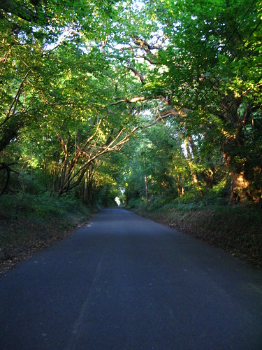
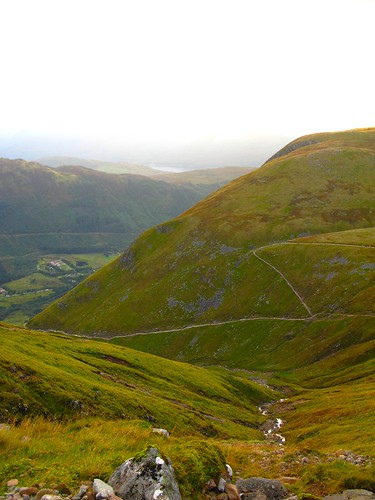
We followed the up and down curvature of the Seven Sisters, named for the seven hills of the coastline, giving our legs a good workout. These cliffs are made of chalk, and are currently receding 30-40cm every year.


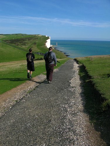
As we curled around another steep point, it got a little more crowded. Walkers were playing "Look how far to the edge I am!" with each other, waving the arms with their mouths open as they posed for photos.

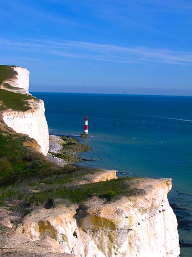
I like to walk pretty close to the edge too. Somehow the sight of the blue sea and the seabreeze revitalised me. Dr. J and Ali preferred to keep a more prudent distance in. But this sight of the famous Belle Tout was worth the risk. This Lighthouse was built to protect ships from the hazardous protruding cliffs of Beachy Head, recently, it's been turned into private residence.

IMG_4077a

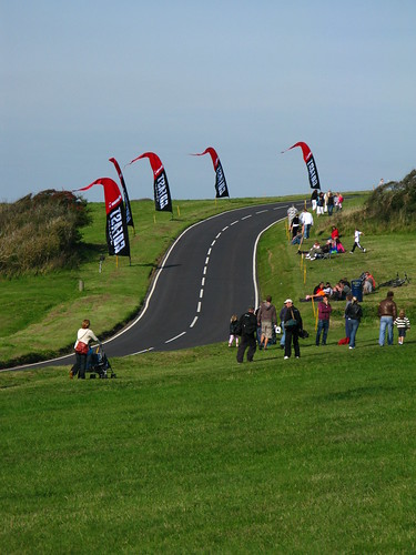
Part of the festivities were also due to a speed-skateboarding race. The racing track had recently been laid over and bikers and skateboarders were showing off their skills.

IMG_4087

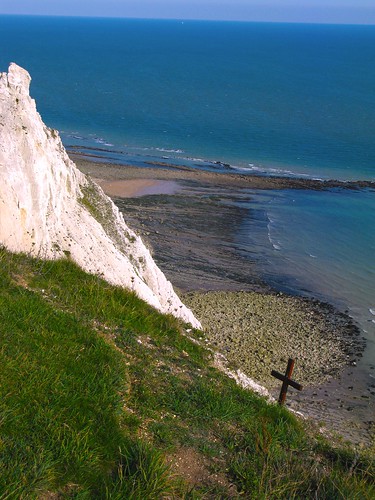
As we reached the peaks of 
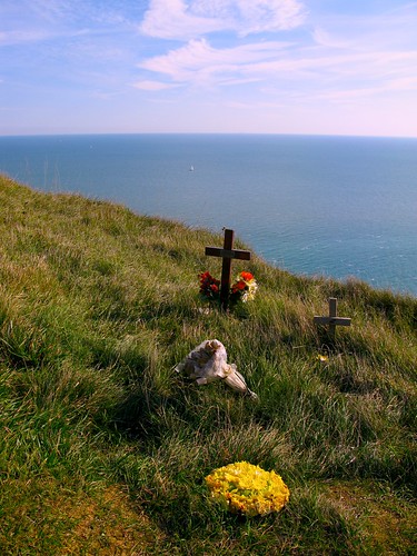
Beachy Head, the highest chalk sea cliff in Britain, I soon came across the various tributes laid for the suicides here. On a warm gorgeous day, it seemed a little criminal to imagine taking your life at this beautiful spot. I could imagine the urge though, if one was stood here in despair in a howling gale with the sea thundering below.

IMG_4096a

IMG_4097a

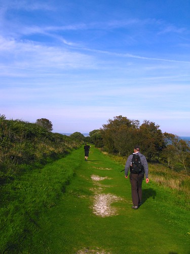
I like this shot. The shape of the path reminds me of the route to Lobuche, where the paths were far narrower and right on the edge. It was a wonder how quickly we got used to it.


IMG_4108a

We spied our final destination over the last curve, the town of Eastbourne, which grew from a stone age settlement. Known as one of the sunniest places in Great Britain, this was once a popular holidaying spot.


It wasn't so bad after all. Admittedly, once we started hitting tarmac again, the feet were definitely aching. But I could have trudged on for a bit more. 10/10 difficulty walk...easy peasy!

IMG_4123a