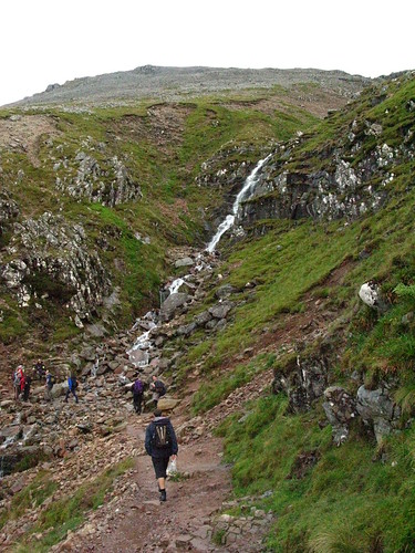
We crossed the wide valley and began the ascent after the first fence.

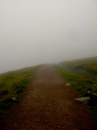
The weather forecast had been rather optimistic. In reality, the weather conditions were less than ideal. It began as being rather damp and chilly, and as we moved further up the mountain, visibility became quite dire with fog and rain. We could just about make out the valley floor between clouds of fog.

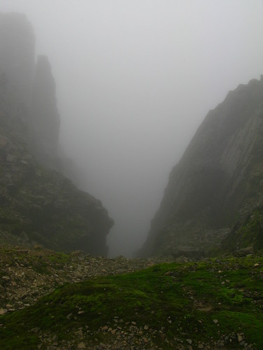
Here, the visibility got pretty bad. I could barely see ten yards ahead. The rain got heavier, until my trousers and bag were soaked, and water was running off my eyebrows and chin.
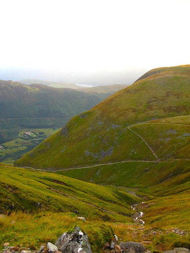
For a brief moment, the winds blew a clearing in the clouds. We could see Lochan Meall an t-Suidhe, which is a little lake nestled high in the mountain range itself. Beyond that, is the elbow formed by the confluence of Loch Linnhe with Loch Eil.

At around 1000m, Dr. J and Jo vetoed and headed back down. I don't blame them at all. The weather and visibility were poor. We were soaked and it was getting quite late in the day.
However, Ali and I decided to push on. I think at the back of my mind, I wasn't sure when we'd head this way again. Though my legs were aching, I kept telling myself I'm pretty lucky to have legs and to be climbing up this mountain. I think it's partly my innate pigheadedness. I really really wanted to get to the top, despite the pain.
Cairns marked the last couple of zig-zag turns near the top, and also to help keep walkers on the path.

Yeah, I don't really want to be wandering off that ledge down the steep fall of the North face. This side is where the climbers emerge, after hauling themselves up the huge buttresses that overlook Coire Leis.
The mist made the summit look suitably spooky, especially with this war memorial, the highest in Britain. Just behind it, lie the old ruins from the Observatory. We didn't stay long, just long enough to share a dram of whisky with a few random hikers.

It's interesting that the etymological meaning of "Ben Nevis" is that it's an anglicisation of the Gaelic name Beinn Nibheis. While beinn is the most common Gaelic word for "mountain", Nibheis is variously understood, though the name is commonly translated as "malicious" or "venomous mountain".

According to the wiki, an alternative interpretation is also that Beinn Nibheis derives from beinn-neamh-bhathais, from Neamh "heavens, clouds" and bathais "top of a man's head". A literal translation would therefore be "the mountain with its head in the clouds", though "mountain of Heaven" is also frequently given. On our way down, a gust of wind blew the clouds aside, cleared our vision and we caught a glimpse of Loch Linnhe. It was quite breathtaking.

It took ages to get down the mountain. With wet, slippery rocks, I found myself moving with great caution. After what seemed like forever, we finally reached the stream we crossed on the way up.
As dusk fell, that beautiful pre-sunset glow hit the hills. It would be another couple of hours before we hit ground, got out of our wet clothes and foraged for a late dinner.

For more details on the Ben Nevis trail, check out this website.
No comments:
Post a Comment